 |
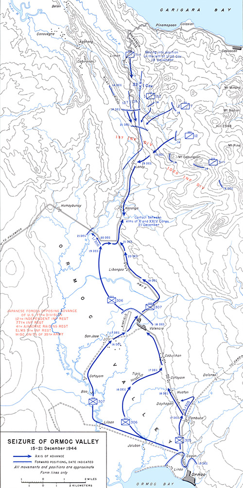
Map of Seizure of Ormoc Valley 15-21 December 1944
The blue line with arrow indicates the axis of advance. The line with hatching indicates forward positions, dates indicated. The map includes locations on Leyte including Omoc Bay, Ormoc, Highway 2, Valencia, Valencia Airfield, Kananga, Lonoy, Limon, Mount Cabungaan, Pinamopoan and Capoocan bordering Carigara Bay. Named features include Breakneck Ridge, Kilay Ridge. The northern advance shows the divisional boundry between the 32nd Infantry Division and 1st Cavalry Division.
Credit: U.S. Army Date: December 15, 1944–December 21, 1944
Map
High Resolution Version
Acquire This Image |
Contribute Information
Do you have photos or additional information?
Previous Page
|
|