Pacific Wrecks
Pacific Wrecks    
  Missing In Action (MIA) Prisoners Of War (POW) Unexploded Ordnance (UXO)  
Chronology Locations Aircraft Ships Submit Info How You Can Help Donate

PacificWrecks.com
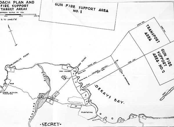
Map Beach Plan and Fire Support Target Areas for Operation Michaelmas the amphibious landing at Saidor
The black line indicates areas on the Rai Coat of New Guinea including Wab, Helmholtz Point, Nankina River, Saidor, Saidor Airfield, Saui Point and Saui Beaches bordering Dekays Bay. with the amphibious landing points indicated: Beach Red, Beach White and Beach Blue.
Credit: NARA U.S. Navy, 7th Fleet Report of Saidor Operation  Date: January 2, 1944
Map  

High Resolution Version
Acquire This Image
|
 

Contribute Information
Do you have photos or additional information?

Previous Page

  Discussion Forum Daily Updates Reviews Museums Interviews & Oral Histories  
 
Pacific Wrecks Inc. All rights reserved.
Donate Now Facebook Twitter YouTube Instagram