 |
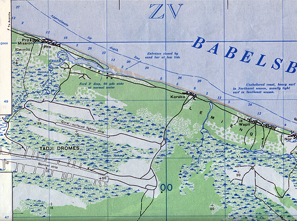
Map of Tadji Dromes inland from the north coast of New Guinea
The map indicates the north coast with Pro Mission, Pro, mouth of the W Creek, Korako, Wapil and Nor (Lemieng Villages). At the center left is the fighter strip annoted as "coral surfaced fighter strip" in a kunai grass area and further to the south is the Bomber Strip with dispersal areas and roads indicated by solid black lines and trails by dotted black lines.
Credit: U.S. Army Date: March 1944
Map
High Resolution Version
Acquire This Image |
Contribute Information
Do you have photos or additional information?
Previous Page
|
|