|
|
|
|
| Missing In Action (MIA) | Prisoners Of War (POW) | Unexploded Ordnance (UXO) |
| Chronology | Locations | Aircraft | Ships | Submit Info | How You Can Help | Donate |
|
 USAAF March 1944 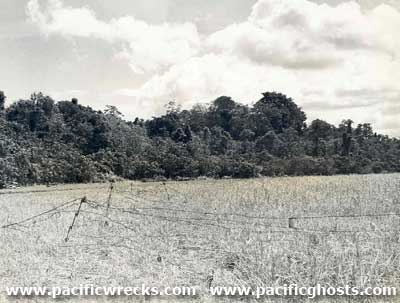 USMC 1944 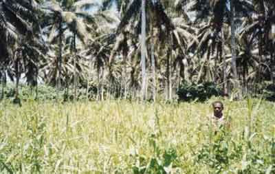 Stan Gajda 1999 |
Location Crash Strip (The Grassy Strip) was located near Coffin Corner, running roughly east to west inland from the north coast of Guadalcanal in the Solomon Islands. Construction This runway was built by the U.S. as an emergency strip for aircraft. Wartime History In October 1942, this location was at the edge of the U.S. perimeter line guarded by U.S. Marine Corps (USMC) General Puller known as "Puller's Line". During the night of October 25-26, 1942 the crash strip was located at the edge of the Battle of Coffin Corner. John Innes adds: "At the time of the Battle of Coffin Corner October 25-26, 1942 there was a roller on the Crash Strip. During the attack the code word 'Banzai' was flashed to Japanese headquarters meaning 'right wing has captured the airfield'. The Japanese saw they were on an airfield (the Crash Strip) and mistakenly thought it was part of Henderson Field. History books never say this. They say that the Japanese commander was suffering from malaria and in a fevered state of mind mistakenly sent the 'Banzai' message. It is far more likely that a Japanese runner had come back saying that they were engaging the enemy on an airfield which in fact was the Crash Strip." Peter Flahavin adds: "General Twining (commander 13th AF in January 1943) says in his book that the crash strip was secret, hardly used and appeared on no map. The fact that it looked like some sort of field probably caused the Japanese to think and report that they had taken Henderson in the October battle." Stan Gajda adds: "I believe this is Crash Strip that the Japanese thought was the main field when they sent back the message 'Banzai' during the October Battle thinking they were attacking Henderson Field. As you can see the grass is now head high. This is because the cows that kept the grass down between the more recently planted coconut trees have been eaten. Coffin Corner is in the background." References Thanks John Innes, Peter Flahavin and Stan Gajda for additional information Contribute
Information Last Updated
|
Map October 1942 |
| Discussion Forum | Daily Updates | Reviews | Museums | Interviews & Oral Histories |
|