 |
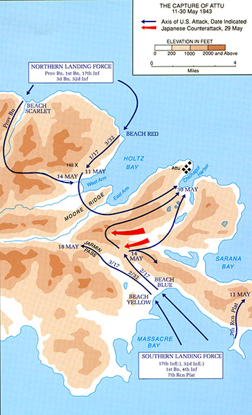
Map of The Capture of Attu 11-30 May 1943
Northern Landing Force: Prov Bn, 1st Bn, 17th Inf 3 Bn, 32nd Inf landing at Beach Scarlet and Beach Red at Holtz Bay. Southern Landing Force: 17th Inf(-), 32d Inf(-) 1st Bn, 4th Inf, 7th Rcn Plat landing at Massacre Bay Beach Yellow and Beach Blue. Locations on Attu Island include Holtz Bay, West Arm, East Arm, Hill X, Moore Ridge, Jarmin Pass, Chichagof Harbor, Sarana Bay, Massacre Bay.
Blue arrows: Axis of U.S. attack, date indicated.
Red arrows: Japanese counterattack, 29 May.
Credit: U.S. Army Date: May 11-30, 1943
Map
High Resolution Version
Acquire This Image |
Contribute Information
Do you have photos or additional information?
Previous Page
|
|