|
|
|
|
| Missing In Action (MIA) | Prisoners Of War (POW) | Unexploded Ordnance (UXO) |
| Chronology | Locations | Aircraft | Ships | Submit Info | How You Can Help | Donate |
|
  USN prewar    IJA 1942 |
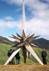
Location Attu Island is located in the Near Island Group (Near Islands) in the Aleutian Island Chain (Aleutian Islands) in Alaska in the United States. Attu Island borders Casco Cove, Chichagof Harbor, Holtz Bay (Asahi Bay) and Massacre Bay. Attu is approximately 20 miles by 35 miles and is the westernmost island in the Near Island Group (Near Islands). Located over a thousand miles from the Alaskan mainland and 750 miles northeast of the northernmost of the Kurile Islands. To the southeast is the Agattu Strait and Agattu Island. To the east is the Semichi Pass and Semichi Island Group (Semichi Islands) and the Rat Island Group (Rat Islands) including Kiska Island. Prewar Prior to 1942, "Attu village" was the only settlement on Attu Island bordering Chichagof Harbor. Attu village consisted of a school, radio tower, Russian Orthodox church and several wooden houses. Wartime History On June 7, 1942 the Japanese Army 301st Independent Infantry Battalion lands 1,200 soldiers lands without opposition at Chichagof Harbor on eastern Attu. They captured 45 native Aleut people and two American civilians Charles Foster Jones and his wife. Charles died, either by suicide, or was killed by the Japanese. His wife received medical treatment from the Japanese and she and the Aleuts were transported aboard ship to Kiska where she was transferred to another vessel and taken to Japan and spent the rest of the war as detainee in Japan. During captivity, roughly half the Attuan population died of disease or starvation. On June 10, 1942 the Japanese landing was confirmed by a PBY Catalinas. Afterwards, heavy bombers and flyingboats began a bombing campaign against Attu, later joined by medium bombers and fighters. American and Japanese missions against Attu June 7, 1942–October 13, 1943 On March 27, 1943 in the morning Battle of the Komandorski Islands (Battle of the Bering Sea) occurred 150 miles west of Cape Wrangle on Attu Island. The Japanese Northern Fleet was defeated by U.S. Navy (USN) Task Group Mike, and ended Japan's attempt to gain a greater foothold in the Aleutians and cut off their garrisons on Attu and Kiska from resupply. American forces planned "Operation Sandcrab" to liberate Attu. Prior to the landing, U.S. Navy warships conducted shore bombard of targets on Attu. On May 11, 1943 the U.S. Army landed 2,000 troops of the "northern force" near Holtz Bay and a "southern force" at Massacre Bay. Defending the eastern portion of the island were 2,600 Japanese troops. By May 17-18, the northern and souther forces linked up at Holtz Massacre Pass and compressed the surviving Japanese into the eastern corner of the island. On May 29, 1943 after 19 days of combat, the surviving 1,000 Japanese launched a suicidal Banzai charge gyokusai to kill themselves. On May 30, 1943 the U.S. Army declared the island secured. In total, the U.S. Army sustained 3,829 casualties including 549 KIA, 1,148 WIA and 1,200 with severe cold injuries; 614 from disease; and a remaining 318 to miscellaneous causes. This casualty rate amounted to roughly 25% of the invading force, a rate second only in proportion to the casualties later sustained on Iwo Jima. The Japanese lost 2,351 KIA and hundreds more were presumed to have been killed prior to the invasion. Only 28 enlisted men were taken prisoner by American forces. Postwar At the end of the war, the surviving Aleuts people and Mrs. Jones were repatriated to the United States. The US government would not allow the Aleuts to return to Attu and they settled at another location in the Aleutians, loosing Attu as their ancestral home. Today The U.S. Coast Guard (USCG) maintained a small Loran station on Attu. The island is protected as part of the National Parks Trust territory and few people visit the island or area, as it is restricted.  Engineer Hill / Japanese War Memorial Engineer Hill / Japanese War MemorialA star shaped memorial atop Engineer Hill erected a 25' titanium Japanese War Monument, dedicated to all who lost their lives during the battle and to future world peace. 75mm Type 88 Anti-Aircraft Gun Emplaced by the Japanese on Attu and captured by the US Army in May 1943 and remains in situ. Casco Cove Borders Alexai Point the southeast coast of Attu near Attu Airfield. Attu Airfield (Alexai Point, Casco Field, NAS Attu, CGS Casco Cove) Wartime airfield, disused today Holtz Bay (Asahi Bay) Located on the northeastern corner of Attu Attu Airfield (Japanese) Japanese construction, never completed Massacre Bay Located on the the southern coast of Attu Island Chichagof Harbor Located on the eastern side of Attu Island. Along the western shore is Attu village P-38G Lightning Serial Number 42-13400 Pilot Nesmith force landed January 1, 1945 recovered in 1998 References The Aleutians - Attu, Aleutian Islands, Alaska Associated Press (AP) Bloody but forgotten WWII battle still haunts soldiers" by Mark Thiessen and Mari Yamaguchi May 28, 2018 Contribute
Information Last Updated
|
Map May 1943 Map Fallingrain Photo Archive |
| Discussion Forum | Daily Updates | Reviews | Museums | Interviews & Oral Histories |
|