|
|
|
|
| Missing In Action (MIA) | Prisoners Of War (POW) | Unexploded Ordnance (UXO) |
| Chronology | Locations | Aircraft | Ships | Submit Info | How You Can Help | Donate |
|
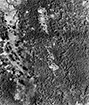  13th AF Oct 31, 1943 |
Location Kara village is located on southern Bougainville Island. Nearby is Toripoli village. To the south is postwar Buin (Buin Town). Prewar and during the Pacific War, part of the Kieta District in the Territory of New Guinea. Postwar, part of Bougainville Province or North Solomons Province. On September 16, 1975 became part of Papua New Guinea (PNG). On June 25, 2002 became the Autonomous Region of Bougainville (AROB). Wartime History During early 1942, occupied by the Japanese. Starting in the middle of September 1943 targeted by Allied planes until the end of 1944. Occupied by the Japanese until the official surrender of Japan in September 1945. American missions against Kara September 15, 1943–October 15, 1944 Kara Airfield (Toripoli Airfield, Buin Airport) Japanese built airfield near Kara village and Buin. Used until 1989 by Air Niugini and known as Buin Airport. Contribute
Information Last Updated
|
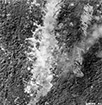
Map Oct 6, 1943 |
| Discussion Forum | Daily Updates | Reviews | Museums | Interviews & Oral Histories |
|