 |
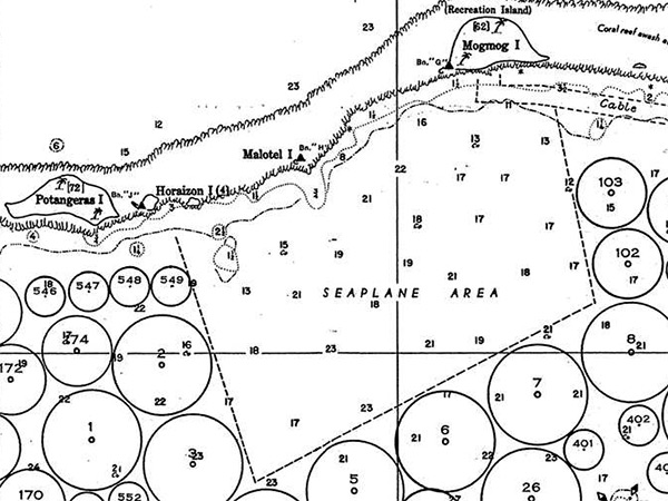
Map of seaplane area in Ulithi Lagoon (Urushi Lagoon) at Ulithi Atoll
Indicated is "seaplane area" for take off and landing by seaplanes and flying boats. Also indicated is Potangeras Island, Horaizon Island, Malotel Island and Mogmog Island (Recreation Island) and underwater cable and the fringing coral reef. The circles indicate 834 berths of three sizes for different types of vessels. Berth Numbers 1-100 were 1,000 yards in diameter for the largest vessels. Berth Numbers 101 to 400 were 700 yard in diameter for medium sized vessels. Berth Number 401-834 were 400 yards in diameter for smaller vessels.
Credit: USN Date: June 1945
Map Enlargement
High Resolution Version
Acquire This Image |
Contribute Information
Do you have photos or additional information?
Previous Page
|
|