Pacific Wrecks
Pacific Wrecks    
  Missing In Action (MIA) Prisoners Of War (POW) Unexploded Ordnance (UXO)  
Chronology Locations Aircraft Ships Submit Info How You Can Help Donate

PacificWrecks.com
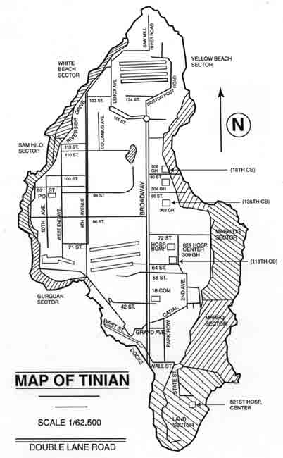
Map of Tinian Island in the Mariana Island Group (Mariana Islands)
Scale 1:62,500 with single and double lane roads indicated. At the northern tip is Ushi Point bordering the Saipan Channel. On the northeast edge is "Yellow Beach Sector". On the northwest edge is "White Beach Sector" further to the west is Sam Hilo Sector and Gurguan Sector.
Credit: USAAF  Date: 1945
Map  

High Resolution Version
Acquire This Image
|
   

Contribute Information
Do you have photos or additional information?

Previous Page

  Discussion Forum Daily Updates Reviews Museums Interviews & Oral Histories  
 
Pacific Wrecks Inc. All rights reserved.
Donate Now Facebook Twitter YouTube Instagram