Missing In Action (MIA)
Prisoners Of War (POW)
Unexploded Ordnance (UXO)
Chronology
Locations
Aircraft
Ships
Submit Info
How You Can Help
Donate
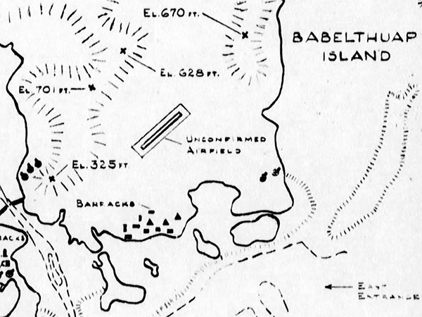
Map of
Airai (A Irai, Irria, Airrai)
in
Airai State
on
Babelthuap Island
in
Palau (Belau)
"Unconfirmed airfield" is
Airai Airport (Babelthuap Airfield, Palau International Airport)
near
Apari
In the southern portion of
Babelthuap Island
. Anti-aircraft guns were emplaced along the southern coast around Airai and
Aimeliik State
. Also noted is the East Entrance to to
Palau Harbor (Palau Anchorage, Koror Roads)
at lower left is the edge of
Koror Island
.
Credit: USN Date: March 30, 1944
Map
Enlargement
High Resolution Version
Acquire This Image
|
Contribute Information
Do you have photos or additional information?
Previous Page
Discussion Forum
Daily Updates
Reviews
Museums
Interviews & Oral Histories
Pacific Wrecks Inc.
All rights reserved.