Missing In Action (MIA)
Prisoners Of War (POW)
Unexploded Ordnance (UXO)
Chronology
Locations
Aircraft
Ships
Submit Info
How You Can Help
Donate
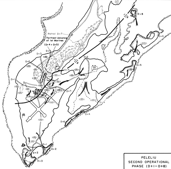
Map of
Peleliu
Second Operational Phase (D+1–D+8)
Map depicts the line of advance by the U.S. Marine Corps (USMC) 1st Marine Division from September 16, 1944 (D+1) until September 24, 1944 (D+8) on
Peleliu Island
. Also indicated is
Peleliu Airfield
,
Un-named Island (Island X)
,
Hill 100 (Higashiyama. Pope's Ridge)
.
Credit: USMC Date: September 16–23, 1944
Map
High Resolution Version
Acquire This Image
|
Contribute Information
Do you have photos or additional information?
Previous Page
Discussion Forum
Daily Updates
Reviews
Museums
Interviews & Oral Histories
Pacific Wrecks Inc.
All rights reserved.