 |
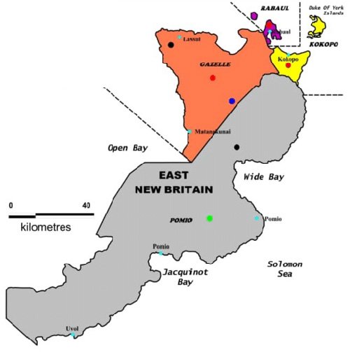
Map of the four districts of East New Britain Province in Papua New Guinea
(Red) Rabaul District, (Yellow) Kokopo District, (Orange) Gazelle District and (Gray) Pomio District. Also indicated is Rabaul, Kokopo, Lassal, Pomio, Pomlo, Uvol, the Duke of York Islands, Open Bay, Wide Bay, Jacquinot Bay and the Solomon Sea.
Credit: PNG Department of Lands and Physical Planning Date: 2020
Map
High Resolution Version
Acquire This Image |
Contribute Information
Do you have photos or additional information?
Previous Page
|
|