 |
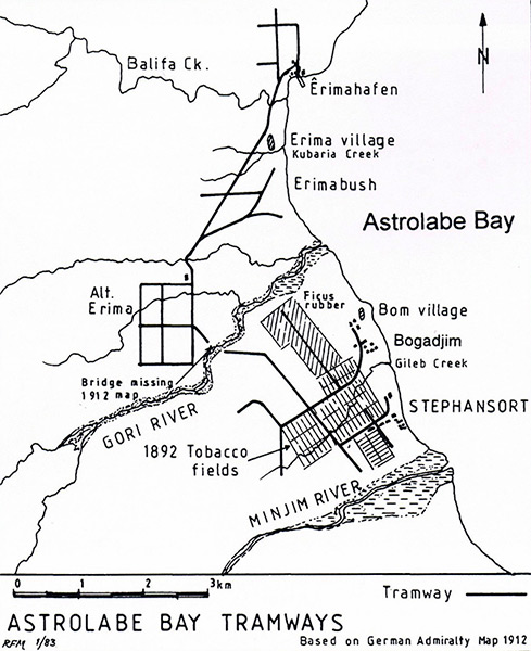
Map of Astrolabe Bay Tramways
Indicated is Balifa Creek, Erimahafen, Erima village, Kubaria Creek, Erimabush, Alternate Erima, Gori River, Bridge, Bom village, Bogadjim, Gileb Creek, Stephansort and the Minjim River.
This map based on German Admiralty Map 192 showing the north coast of New Guinea bordering Astrolabe Bay with the tramways (narrow gague railway lines 600mm) from Stephansort to 4.5km to the north then across a bridge over the Gori River to Alternate Erima and then 4km north to Erima.
Credit: End of the Line page 11 Date: 1912
Map
High Resolution Version
Acquire This Image |
Contribute Information
Do you have photos or additional information?
Previous Page
|
|