Pacific Wrecks
Pacific Wrecks    
  Missing In Action (MIA) Prisoners Of War (POW) Unexploded Ordnance (UXO)  
Chronology Locations Aircraft Ships Submit Info How You Can Help Donate

PacificWrecks.com
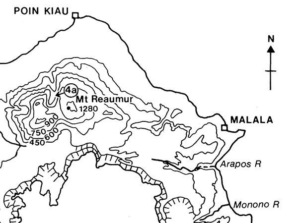
Map of Poin Kiau and Malala on western Long Island (Arop, Ahrup, Pono) in the Vitiaz Strait
Long Island includes Mount Reaumur with an elevation of 4,199' / 1,280m. On the northern coast is Poin Kiau at Kiau Point. On the northeast coast is Malala. In the center is Lake Wisdom a flooded volcanic caldera. The map also indicates the mouth of rivers including Monono River and Arapos River.
Credit: Long Island, Papua New Guinea: Introduction page 409  Date: 1982
B&W   Enlargement

High Resolution Version
Acquire This Image
|
 

Contribute Information
Do you have photos or additional information?

Previous Page

  Discussion Forum Daily Updates Reviews Museums Interviews & Oral Histories  
 
Pacific Wrecks Inc. All rights reserved.
Donate Now Facebook Twitter YouTube Instagram