Missing In Action (MIA)
Prisoners Of War (POW)
Unexploded Ordnance (UXO)
Chronology
Locations
Aircraft
Ships
Submit Info
How You Can Help
Donate
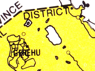
Map of the
Waigani Swamp Gavagabada
(center white shape)
To the west is
Gerehu
to the north is
17 Mile Drome (Durand)
and the present day border between
National Capital District (NCD)
and
Central Province (CP)
Credit: National Mapping Bureau, Central Province Sheet 2 of 3 Date: 1970s
Map
High Resolution Version
Acquire This Image
|
Contribute Information
Do you have photos or additional information?
Previous Page
Discussion Forum
Daily Updates
Reviews
Museums
Interviews & Oral Histories
Pacific Wrecks Inc.
All rights reserved.