 |
Map of the Japanese Attack on Driniumor Line Night 10-11 July 1944 during the Battle of the Driniumor River
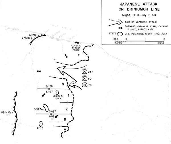
Indicated is the north coast of New Guinea and the Driniumor River. The arrows show the axis of Japanese attack across the Driniumor River at the start of the Battle of the Driniumor River against the American line on the western shore defended (from north to south) by 128th Infantry Regiment, 2nd Battalion F Company and G Company. At the center was the 127th
Infantry Regiment, 3rd Battalion I Company and K Company. Furthest to the south was the Cavalry Regiment, 1st Battalion, B Company and A Company. The arrows indicate the Japanese axis of attack. The black arrows indicate the approximate positions of forward Japanese elements by the evening of July 11, 1944. The black line with hatches and circles indicate American positions during the night of July 11, 1944 to July 12, 1944.
Credit: U.S. Army Date: July 10, 1944–July 12, 1944
Map
High Resolution Version
Acquire This Image |
Contribute Information
Do you have photos or additional information?
Previous Page
|
|