|
Location
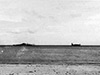
Ela Beach is part of Port Moresby on the southern coast of New Guinea bordering Walter Bay to the south. To the east is Koki (2 Mile). To the west is Paga Hill and to the north is Port Moresby (Town) and northeast is Tuaguba Hill (Ack Ack Hill). Offshore to the south is Local Island (Manubada Island). Inland from Ela Beach, the Beach Road (Moresby Road / Ela Beach Road) was established running rougly west to east and connecting to Lawes Road at the eastern end. Today, Ela Beach is located in the National Capital District (NCD) of Papua New Guinea.
Prewar
During the 1930s, Parer landed on Ela Beach.
Wartime History
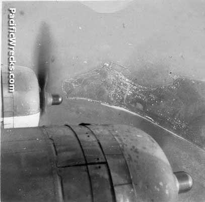
During 1940 Walter Bay off Ela Beach was used as a mooring area for Royal Australian Air Force (RAAF) flying boats operating from Port Moresby. On February 17, 1940 S.23 "Calypso" A18-11 and S.23 "Centaurus" A18-10 were moored at this location as part of a RAAF survey flight operating in New Guinea. Between May 1940 until the start of the Pacific war, used to investigated suspicious movements, defend trade and conduct periodic reconnaissance over Port Moresby, Rabaul, Tulagi and Port Vila, organize a radio network, establish Advance Operational Bases (AOBs) and defend Port Moresby.
During the early months of the Pacific War, barbed wire and obstacles were placed on Ela Beach to deter a potential Japanese landing at this location. Later in 1942, the Ela Beach area became a camp area for Allied troops with pyramid tents lining the beach.
Postwar
After World War II, Ela Beach was planted with trees by the Governor General's wife Rachel Cleland was part of a postwar beautification project.
Today
Ela Beach was a popular beach area used by local people for bathing and picnics. During the 1980s, an underwater observation room was built off Ela Beach but was disused by the late 1990s.
Around 2015 a road expansion project began constructing a two lane highway from the edge of Ela Beach toward Paga Hill by Curtain Brothers. Next, China Harbor began a project to expand and replace the Beach Road (Moresby Road / Ela Beach Road). This
and resulted in all the trees planted postwar being cut down. During 2017-2018, land fill has been added to Ela Beach, destroying the original beach area and extending the shoreline for new buildings including the APEC Haus for the APEC Conference in November 2018.
Ela Beach Memorial
Located at Ela Beach
flanked by two flag poles.
Contribute
Information
Do you have photos or additional information to add?
Last Updated
March 20, 2022
|