|
|
|
|
| Missing In Action (MIA) | Prisoners Of War (POW) | Unexploded Ordnance (UXO) |
| Chronology | Locations | Aircraft | Ships | Submit Info | How You Can Help | Donate |
|
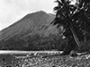 AWM c1915 |
Location Lat 4° 12' 0S Long 152° 11' 60E Nordup is located at an elevation of 830' / 252m on the north coast of the Gazelle Peninsula in northeastern New Britain. Also known as "Nodup". Further to the southwest is Rabaul. Between 1884 until September 1914 part of Deutsch Neu Guinea (German New Guinea). Prewar and during the Pacific War part of the New Britain District in the Territory of New Guinea. Today located in East New Britain Province of Papua New Guinea (PNG). Wartime History On January 23, 1942 after midnight the Japanese Army 144th Infantry Regiment "South Seas Detachment" landed at Nordup and several other locations in the vicinity of Rabaul. During 1944, attacked by Allied bombers and fighters. Occupied by the Japanese for the duration of the Pacific War until September 1945. American missions against Nordup May 29, 1944–June 24, 1944 Contribute
Information Last Updated
|
Map Fallingrain |
| Discussion Forum | Daily Updates | Reviews | Museums | Interviews & Oral Histories |
|