Missing In Action (MIA)
Prisoners Of War (POW)
Unexploded Ordnance (UXO)
Chronology
Locations
Aircraft
Ships
Submit Info
How You Can Help
Donate
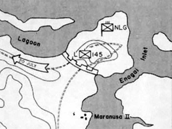
Enlargement of Map of The Attack on Bairoko
The map indicates the U.S. Northern Landing Group (NLG) advance on
July 20, 1943
westward towards the
Dragons Peninsula (Dragon Point)
and beyond to
Bauroko (Bairoko)
. In the center is
Enogai
,
Enogai Inlet
, Maranusa II and walking trails indicated.
gons Peninsula (Dragon Point)
to
Bauroko (Bairoko)
.
Credit: USMC Map 9 Date:
July 20, 1943
Map
Enlargement
High Resolution Version
Acquire This Image
|
Contribute Information
Do you have photos or additional information?
Previous Page
Discussion Forum
Daily Updates
Reviews
Museums
Interviews & Oral Histories
Pacific Wrecks Inc.
All rights reserved.