Missing In Action (MIA)
Prisoners Of War (POW)
Unexploded Ordnance (UXO)
Chronology
Locations
Aircraft
Ships
Submit Info
How You Can Help
Donate
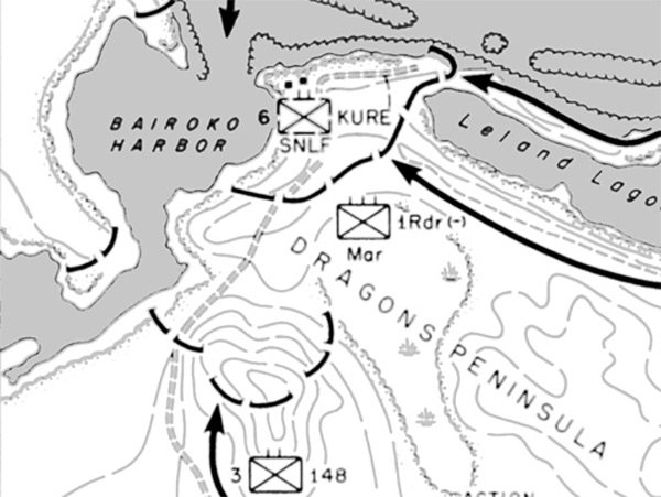
Enlargement of Map Approach To Bairoko 5-20 July 1943
The map indicates the north coast of
New Georgia
bordering
Kula Gulf
including
Bairoko Harbor
,
Bairoko
,
Dragons Peninsula
,
Leland Lagoon
,
Enogai (Enogai Point)
,
Enogai Inlet
. The solid black lines indicates the American axis of advance and dates. The dotted line indicates Japanese positions. At the lower left is an insert map showing the location of
Arundel Island
,
New Georgia
and
Vila
on
Kolombangara Island
bordering
Kula Gulf
.
Credit: U.S. Army Map 8 Date: July 2, 1943–July 15, 1943
Map
Enlargement
High Resolution Version
Acquire This Image
|
Contribute Information
Do you have photos or additional information?
Previous Page
Discussion Forum
Daily Updates
Reviews
Museums
Interviews & Oral Histories
Pacific Wrecks Inc.
All rights reserved.