Pacific Wrecks
Pacific Wrecks    
  Missing In Action (MIA) Prisoners Of War (POW) Unexploded Ordnance (UXO)  
Chronology Locations Aircraft Ships Submit Info How You Can Help Donate

PacificWrecks.com
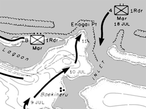
Enlargement of Map Approach To Bairoko 5-20 July 1943
The map indicates the north coast of New Georgia bordering Kula Gulf including Leland Lagoon, Enogai (Enogai Point), Enogai Inlet, Boekineru. The solid black lines indicates the American axis of advance and dates. On July 18, 1943 the 4th 4th Raider Battalion lands at Enogai as reinforcements.
Credit: U.S. Army Map 8  Date: July 2, 1943–July 15, 1943
Map   Enlargement

High Resolution Version
Acquire This Image
|
 

Contribute Information
Do you have photos or additional information?

Previous Page

  Discussion Forum Daily Updates Reviews Museums Interviews & Oral Histories  
 
Pacific Wrecks Inc. All rights reserved.
Donate Now Facebook Twitter YouTube Instagram