Missing In Action (MIA)
Prisoners Of War (POW)
Unexploded Ordnance (UXO)
Chronology
Locations
Aircraft
Ships
Submit Info
How You Can Help
Donate
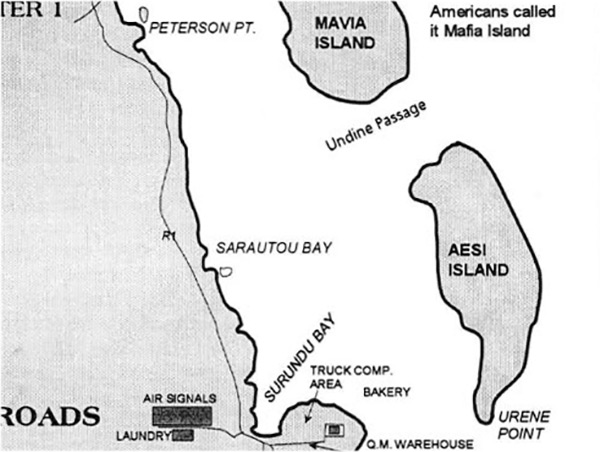
Map of
Aesi Island
and
Mavia Island (Mafia)
off the the eastern edge of
Espiritu Santo
circa 1942
Indicated is
Aesi Island
, Undine Passage and
Mavia Island (Mafia)
. To the west is the eastern edge of
Espiritu Santo
includng the northern edge of
Lunganville (Santo)
including Q. M. Warehouse, Truck Company Area, Bakery, Surundu Bay, Air Signals, Laundry, Sarautou Bay and Peterson Point connected by R1 road.
Credit:
The Lady and the President
Date: 1997
Map
Enlargement
High Resolution Version
Acquire This Image
|
Contribute Information
Do you have photos or additional information?
Previous Page
Discussion Forum
Daily Updates
Reviews
Museums
Interviews & Oral Histories
Pacific Wrecks Inc.
All rights reserved.