 |
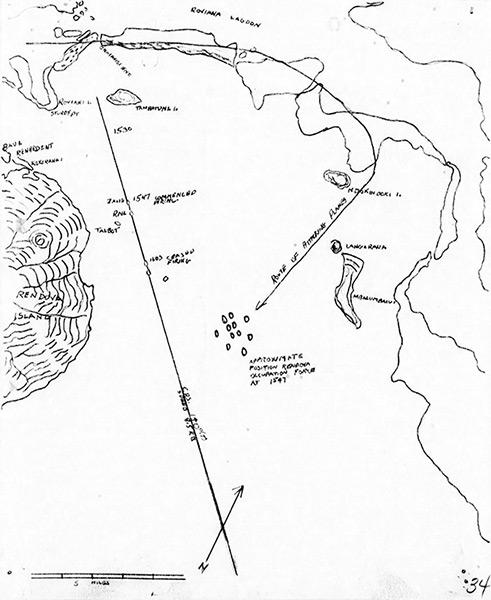
Map of the USS Zane (DMS-14) track on June 30, 1943
The map shows the Blanche Channel bordering to the north Roviana Lagoon and beyond the southern coast of New Georgia with Rendova Island. Inside Blanche Channel is Tambatung Island Ndoking Island, Langaranga Island and Mbalumbaiu Island. At the northern end is Onaiavisi Channel between Sasavele Island (Dume Island) and Baraulu Island. The solid line representing the track of USS Zane (DMS-14), USS Rail (AT-139) and USS Talbot (APD-7). The curved line with arrow indicates "Route of Attacking Planes" the formation of Japanese G4M1 Bettys escorted by A6M Zeros that targeted the U.S. task force indicating "approximate position Rendova occupation force at 1547" withdrawing after the landing on northern Rendova Island.
Credit: USS Zane War Diary June 1943 (Action Report) page 34 Date: June 30, 1943
Map
High Resolution Version
Acquire This Image |
Contribute Information
Do you have photos or additional information?
Previous Page
|
|