Missing In Action (MIA)
Prisoners Of War (POW)
Unexploded Ordnance (UXO)
Chronology
Locations
Aircraft
Ships
Submit Info
How You Can Help
Donate
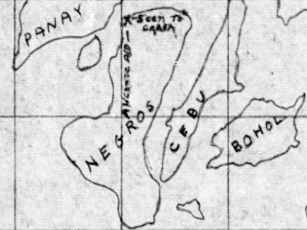
Map depicting the crash of
B-24L Liberator 44-41421
at the north tip of
Negros Island
Indiated is "X - Seen to crash" indicating the crash of
B-24L Liberator 44-41421
to the north of
Alacante Airfield
.
Also indicated is Panay Island,
Guimaras Island
(not labeled),
Negros Island
,
Cebu Island
and
Bohol Island
Credit: MACR 10456 page 4 Date:
November 8, 1944
B&W
High Resolution Version
Acquire This Image
|
Contribute Information
Do you have photos or additional information?
Previous Page
Discussion Forum
Daily Updates
Reviews
Museums
Interviews & Oral Histories
Pacific Wrecks Inc.
All rights reserved.