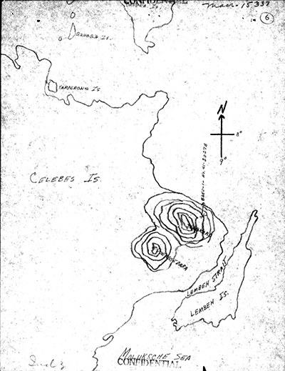
Map depicting the loss of B-25D "Hell's Fire" 41-30278 at the base of Mount Tongkoko on the northeast tip of Celebes (Sulawesi)
The annotation on the northeast corner of Mount Tongkoko indicates * B-25D-1 - No. 41-30278. The black line indicates the northeast coast of Celebes and Lembah Island. Also indicated is Moluksche Sea [sic Molucca Sea], Lembeh Strait, Lembeh Island and Celebes (Sulawesi) with circles indicating Mount Tongkoko and Gunung Duasaudara. At the upper edge are offshore islands including Tamperong Island and Bangka Island. Credit: MACR 15337 page 4 Date: September 2, 1944
Map