Missing In Action (MIA)
Prisoners Of War (POW)
Unexploded Ordnance (UXO)
Chronology
Locations
Aircraft
Ships
Submit Info
How You Can Help
Donate
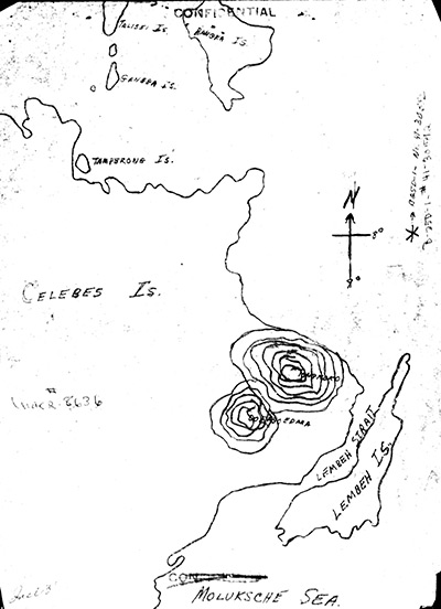
Map depicting the loss of
B-25D "Mexican Spitfire" 41-30592
northeast of
Celebes
and
Lembeh Strait
and
Lembeh Island
The annotation near the compass is indicates * B-25D-1 - No. 41-30592. The black line indicates the northeast coast of
Celebes
and
Lembah Island
. Also indicated is Moluksche Sea [sic
Molucca Sea
],
Lembeh Strait
,
Lembeh Island
and
Celebes (Sulawesi)
with circles indicating Mount Tongkoko and Gunung Duasaudara. At the upper edge are offshore islands including Tamperong Island and Bangka Island.
Credit: MACR 8636 page 6 Date:
September 2, 1944
Map
High Resolution Version
Acquire This Image
|
Contribute Information
Do you have photos or additional information?
Previous Page
Discussion Forum
Daily Updates
Reviews
Museums
Interviews & Oral Histories
Pacific Wrecks Inc.
All rights reserved.