Pacific Wrecks
Pacific Wrecks    
  Missing In Action (MIA) Prisoners Of War (POW) Unexploded Ordnance (UXO)  
Chronology Locations Aircraft Ships Submit Info How You Can Help Donate

PacificWrecks.com
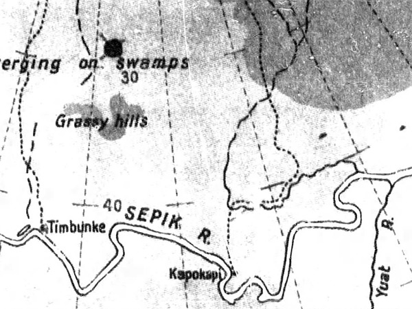
Map of the north coast of New Guinea
The map includes the interior of New Guinea including the Sepik River bordering the Yuat River, Kapokapi and Timbunke. To the north are "gassy hills" and "plain country verging on swamps" with walking trails (dotted lines).
Credit: MACR 3981 page 2  Date: August 30, 1943
Digital   Enlargement

High Resolution Version
Acquire This Image
|
   

Contribute Information
Do you have photos or additional information?

Make A Donation | Previous Page | Pacific Wrecks

  Discussion Forum Daily Updates Reviews Museums Interviews & Oral Histories  
 
Pacific Wrecks Inc. All rights reserved.
Donate Now Facebook Twitter YouTube Instagram