Missing In Action (MIA)
Prisoners Of War (POW)
Unexploded Ordnance (UXO)
Chronology
Locations
Aircraft
Ships
Submit Info
How You Can Help
Donate
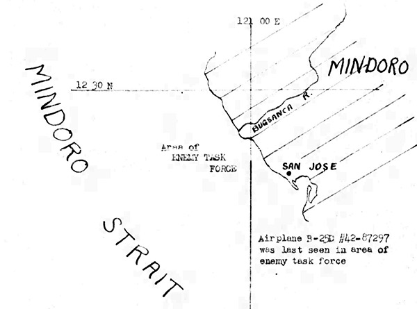
Map depicting the loss of
B-25D "The Mad Mizurian" 42-87297
over the
Mindoro Strait
in the
Philippines
The black line indicates the western coast of
Mindoro Island
, Bugsanca River,
San Jose
and
Mindoro Strait
with "Area of Enemy Task Force" and "Airplane
B-25D #42-87297
was last seen in area of enemy task force". This map is a tracing overlay of AA Aeronautical Chart Number 735D.
Credit: MACR 12603 page 4 Date:
December 26, 1944
Map
High Resolution Version
Acquire This Image
|
Contribute Information
Do you have photos or additional information?
Previous Page
Discussion Forum
Daily Updates
Reviews
Museums
Interviews & Oral Histories
Pacific Wrecks Inc.
All rights reserved.