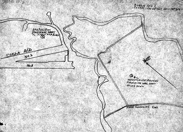
Map depicting the crash of P-38J 44-23526 and pilot 2nd Lt. Henry J. Frank at Boela Airfield on Ceram (Seram) Boela A/D 2 Ceram Lat 03° 06' S Long 130° 30' E. showing the outline of Boela Airfield no. 1 and no. 2 with (X) approximate position plane was seen to crash and burn and (X) approximate position parachute was seen going down. Credit: MACR 8967 page 9 Date: September 11, 1944
Map