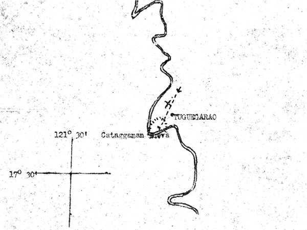
Map of loss location of F-6D "Snooks 5th" 44-14841 near Tuguegarao and Cattagoaman Nuevo on Luzon
This sketch is an overlay to AAF Aeronautical Chart (620 D) Baguio 1:500;000. The circular area in hash marks is the target area of supplies and fuel dumps.
The dash liine is the path of the planes on bomb run from northeast to southwest. The "X" indicates where F-6D "Snooks 5th" 44-14841 was last near.
Credit: MACR 12924 page 4 Date: March 5, 1945
Map
High Resolution Version
Acquire This Image |
Contribute
Information
Do you have photos or additional information?
Make A Donation | Previous Page | Pacific Wrecks |