|
Location
Lat 13° 50' 0" N Long 120° 38' 0" E Located a half mile north of Calatagan on a peninsula north of Cape Santiago. Also known as Canlubang Airfield or Calalagan Airfield. Previously, the area was planted with sugar cane. To the west is Route 413 to Nasugbu. To the east was a narrow gauge railway used to transport sugar cane.
Construction
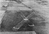
Built prewar by the U.S. Army as an emergency landing ground (ELG) with two intersecting runways. The first runway ran north to south 1,320' x 100'. The second runway was northeast to southwest 2,115' x 100'. Both runways were surfaced with grass and was classed as an all weather strip.
Wartime History
During early January 1942 occupied by the Japanese Army until early 1945. There is no evidence this airfield was used by the Japanese.
American missions against Calatagan
December 18, 1944
December 18, 1944
(FEAF) Fighter-bombers destroy a bridge on the the Palompon-Cananga
road
and pound Calatagan Airfield
References
Index to Air Bases - Research Report No. 85, I.G. No 9185 - July 30, 1944 - Calatagan Airfield
Terrain Study No. 95 Batangas-Lucena November 9, 1944 page 44
Contribute
Information
Do you have photos or additional information to add?
Last Updated
April 19, 2025
|