Missing In Action (MIA)
Prisoners Of War (POW)
Unexploded Ordnance (UXO)
Chronology
Locations
Aircraft
Ships
Submit Info
How You Can Help
Donate
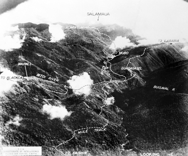
Aerial view northeast of inland trails towards
Mubo
and
Salamaua
Visible are tacks showing the lower elevation Mule Track from Wau via
Kaisenik
to
Mubo
and onward
Komiatum (Kamiaturn)
to
Salamaua
on the north coast of
New Guinea
bordering
Huon Gulf
. At the higher elevation is the track to
Black Cat Pass
via Waipali,
Guadagasel (Guabagusal)
and Lababia. Althougn dated only 1943, likely
February 7, 1943
.
Credit: RAAF via
AWM 101114
Date: 1943
B&W
High Resolution Version
Acquire This Image
|
Contribute Information
Do you have photos or additional information?
Previous Page
Discussion Forum
Daily Updates
Reviews
Museums
Interviews & Oral Histories
Pacific Wrecks Inc.
All rights reserved.