|
|
|
|
| Missing In Action (MIA) | Prisoners Of War (POW) | Unexploded Ordnance (UXO) |
| Chronology | Locations | Aircraft | Ships | Submit Info | How You Can Help | Donate |
|
 December 15, 1942 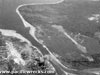 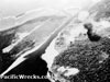 13th AF c1944 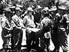 AWM Sept 15, 1945 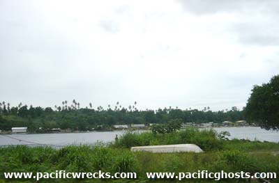 Justin Taylan 2003 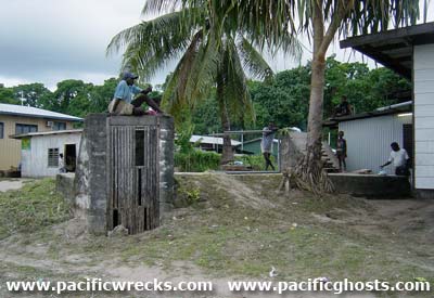 Justin Taylan 2003 |
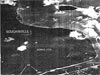
Location Bonis is located at the northwestern tip of the Bonis Peninsula at the northern end of Bougainville. Also known as "Banis". Borders Buka Passage and Buka Island to the north. The coastal down the eastern side of the island begins at Bonis and proceeds southward connecting to Sorum and Ruri. Today located in Selau Suir Rurial LLG of Northern Bougainville District in Autonomous Region of Bougainville in Papua New Guinea (PNG). Prewar Bonis plantation was established at this location planted with coconut palms harvesting copra. Wartime History During April 1942, occupied by the Japanese and developed into a base area. During early 1943, construction was begun on Bonis Airfield and completed by October 1943. The Japanese Navy established a headquarters on the Bonis peninsula, with a portion inside a tunnel dug into the cliff face. Allied missions against Bonis October 29, 1943–June 14, 1944 After the American landings on November 1, 1943 at Empress Augusta Bay, a three-pronged Allied offensive contained the remaining Japanese forces to the Bonis-Buka areas after the occupation of the road junction at Ruri Bay on May 11, 1944. A potential threat to the Australian flank was posed by Japanese artillery emplaced on offshore Saposa Island and Taiof Island. By late May 1944, Australian forces formed a line to the south of Bonis by the 55th/53rd Battalion until relieved on May 19 by the 26th Battalion and on June 3, until the 31st/51st Battalion came forward from Torokina to strengthen the line, but no offensive operations were initiated to capture the Bonis area. Occupied by the Japanese until the middle of September 1945. On September 14, 1945 surrender negotiations began between the Australian Army, 2 Corps headquarters and Imperial Japanese Navy (IJN) Commander Takahashi and Captain E. Kato plus Imperial Japanese Army (IJA) Lt. General M. Kanda that command the remaining Japanese garrison in northern Bougainville. On September 15, 1945 the Australian and Japanese party inspects Bonis Airfield as an assembly area for selected as an assembly area for Japanese Prisoners Of War (POW) surrendering in northern Bougainville. After two days, the negotiations conclude on September 16, 1945. Today The small town of Bonis has only a few buildings close to the beach, across from Buka. A terminus for PMV bus traffic, and small boats crossing the Buka Passage. Bonis Airfield Japanese built airfield, disused since the war. Japanese Bunker Located near the Buka passage. This large bunker had multiple entrances, and excellent construction. Today, a contemporary building is built nearby, and uses the bunker for storage. Wooden doors are built over two of the entrances visible. Australian Matilda Tank Reportedly in the vicinity. Blown upside down by a the blast of a Japanese land mine that killed the crew. Munitions Caches Unexploded shells recovered by workmen widening the Buka Passage / Tinputz road in the early 1980s. Contribute
Information Last Updated
|
Map 1943 Map Oct 22, 1943 Photo Archive |
| Discussion Forum | Daily Updates | Reviews | Museums | Interviews & Oral Histories |
|