 |
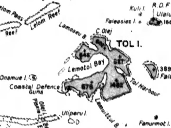
Map of Tol Island inside Truk Lagoon
Borders Tol Harbor to the east, Lemotol Bay to the west, Lamuittul Bay to the south and Lamoseau Bay to the northwest. The northwest portion is Pata Island (Paata) and the southwest is Polle Island with an arrow indicating "Coast Defense Guns" (Battery of four 15cm / 40 cal coastal defense guns) on the southwest corner. To the northeast is Faieasiez Island. To the east is Fal-beguets Island. To the west is Onamuel Island. To the northeast is Faieasiez Island and Ulalu Island. To the east is Fala-Beguets Island. To the southwest is Utiperu Island and the southwestern edge of the outer reef surrounding Truk Lagoon.
Credit: JICPOA Date: February 4, 1944
Map Enlargement
High Resolution Version
Acquire This Image |
Contribute Information
Do you have photos or additional information?
Previous Page
|
|