 |
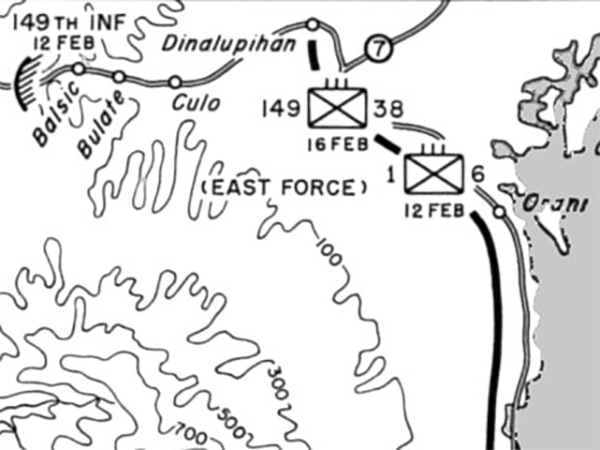
Map of Clearing Bataan February 12-21, 1945
Depicts U.S. Army liberation of Bataan Peninsula on Luzon. On February 12, 1945 the hatched line indicates 152nd Infantry advancing eastward from Olongapo and the 149th Infantry advancing westward from Balsic linked up, isolating the Japanese on the Bataan Peninsula. Meanwhile, on February 12, 1945 the "East Force" black solid line indicates their advance to Orani then southward along the eastern coast and by February 16, 1945 reached Limay.
Credit: U.S. Army Map 15 by F. Temple Date: February 12-14, 1945
B&W Enlargement
High Resolution Version
Acquire This Image |
Contribute Information
Do you have photos or additional information?
Previous Page
|
|