 |
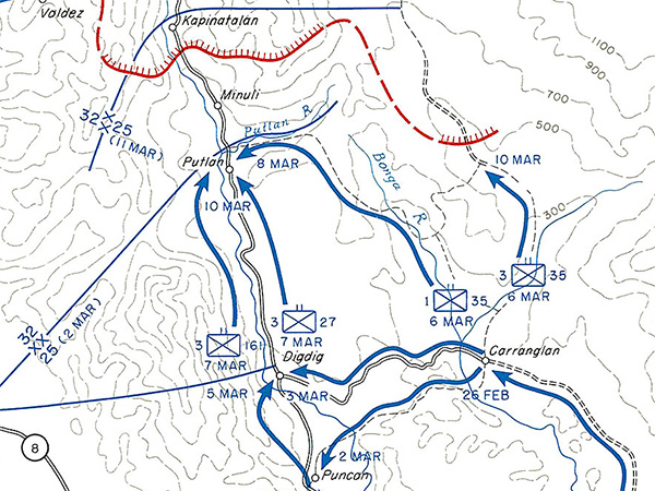
Enlargement of map of Advance Towards Santa Fe I Corps 21 February–10 March 1945
Indicated is Highway 5 with Puncan, Digdig, Putlan, Minuli, Kapinatalan. The solid blue line is the divisional boundary between the 32nd Infantry Division to the north and 25th Infantry Division to the south. The blue arrows indicate the U.S. axis of advance of the 161st Infantry Regiment and 27th Infantry Regiment and 35th Infantry Regiment. The red dotted line and red line with hatches are approximate Japanese Main Line of Resistance (MLR) on March 10, 1945 defended by the Japanese Army 14th Area Army 10th Division.
Credit: U.S. Army, 32nd ID, 127th IR Date: February 21, 1945–March 10, 1945
Map Enlargement
High Resolution Version
Acquire This Image |
Contribute Information
Do you have photos or additional information?
Previous Page
|
|