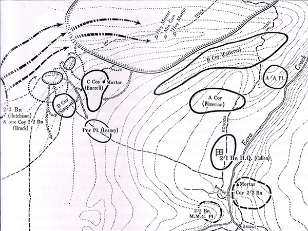
Map of the Battle of Eora Creek Australian advance October 27-28, 1942 At the upper right is Etoa (aka "Lost Battlefield" or "Japanese Forest Fort") to the northwest of Eora Creek village on the Kokoda Trail with a bridge over the Eora Creek in the Owen Stanley Range in New Guinea. On the ridge to the north was a Japanese mountain gun plus two mortars along the Japanese tracks that connected to the north and south of Eora Creek village. The Australian Army 16th Brigade poistions including the 2/3rd Battalion advancing at the flank to the high ground with the 2/2nd Battalion and 2/1st Battalion making a frontal attack on the position. Credit: The Official History via Field Guide to the Kokoda Track page 303 Date: October 27-28, 1942
B&W Enlargement