|
|
|
|
| Missing In Action (MIA) | Prisoners Of War (POW) | Unexploded Ordnance (UXO) |
| Chronology | Locations | Aircraft | Ships | Submit Info | How You Can Help | Donate |
|
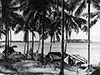 AWM April 27, 1944 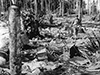 AWM April 27, 1944 |
Location Lat 5° 7' 60S Long 145° 49' 60E Sek Island is a long narrow island oriented roughly north to south forming the eastern edge of Sek Harbor off Alexishafen on the north coast of New Guinea. Prewar and during the Pacific War located in Madang District in the Territory of New Guinea. Today located in Madang Province in Papua New Guinea (PNG). Wartime History During the Japanese occupation, used as a supply area. On April 24, 1944 occupied by a platoon from the Australian Army, 8th Infantry Brigade landed by HMAS Bundaberg (J231). Ashore, they found an abandoned Japanese medical supply dump. A-20G Havoc 42-54083 Pilot Wells ditched March 13, 1944 roughly two miles east of Sek Island Contribute
Information Last Updated
|
Map Mapcarta |
| Discussion Forum | Daily Updates | Reviews | Museums | Interviews & Oral Histories |
|