|
|
|
|
| Missing In Action (MIA) | Prisoners Of War (POW) | Unexploded Ordnance (UXO) |
| Chronology | Locations | Aircraft | Ships | Submit Info | How You Can Help | Donate |
|
 Silk December 25, 1942 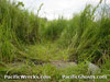 Justin Taylan 2003 |
Location Simemi village and Simemi Creek and the Simemi Trail are located to the east of Buna on the north side of Buna Airfield (Old Strip) and to the west of Buna New Strip. Prewar and during the Pacific War located in the Northern District of Territory of Papua. Today located in Oro Bay Rural LLG, Ijivitari District of Oro Province in Papua New Guinea (PNG). Wartime History During late 1942, the Simemi Creek had only one crossing where a log bridge dubbed Simemi Bridge, also known as Simemi Creek Bridge or simply The Bridge was established as a crossing. Other areas were dominated by swamps and deep water. During the battle of Buna, Simemi Creek was formidable obstacle to the Allies and tanks could not negotiate the area or cross. After six days of heavy fighting, the Australian Army 2/9th Battalion had cleared the Japanese from positions east of Simemi Creek. For three days afterwards, they searched for a safe area to cross Simemi Creek. 2/10th battalion found a crossing downstream and moved across on December 22, 1942. The surprised tanks managed to cross, and abandoned adjacent positions on December 23, 1942. Simemi Bridge (Simemi Creek Bridge, The Bridge) Located to the west of Buna New Strip. Today, the trail here is still used by foot traffic and off road vehicles. The original log bridge has rotted away, but a new bridge made of metal culverts is located at the same crossing. There is a small village at Simemi, with some traces of the war like barbed wire and pigtails and other smaller relics. Contribute
Information Last Updated
|
Map Dec 5, 1942 Map 1943 |
| Discussion Forum | Daily Updates | Reviews | Museums | Interviews & Oral Histories |
|