 |
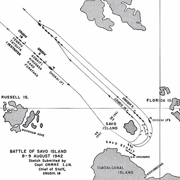
Map of the Battle of Savo Island 8-9 August 1942
The map indicates locations including the Russell Islands, Wernham Cove, Savo Island, Savo Strait, Guadalcanal, Kokumbona, Florida Island (Nggela Sule, Big Gela) and the southern tip of Santa Isabel Island. Sketch submitted by Capt. Ohmae I.J.N. Chief of Staff, CruDiv 18.
The lines indicate the approach and withdrawal of Vice Admiral Mikawa warships Yunagi, Yubari, Tenryu, Furutaka, Kinugasa, Kako, Aoba and Chokai from CruDiv 18 and CruDiv 6 that arrived to the south of Savo Island to the north and engaging U.S. cruisers and destroyers.
Credit: IJN via USN Date: August 8, 1942–August 9, 1942
Map
High Resolution Version
Acquire This Image |
Contribute Information
Do you have photos or additional information?
Previous Page
|
|