|
|
|
|
| Missing In Action (MIA) | Prisoners Of War (POW) | Unexploded Ordnance (UXO) |
| Chronology | Locations | Aircraft | Ships | Submit Info | How You Can Help | Donate |
|
 Justin Taylan 2006 |
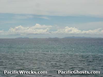
Location Florida Island is the largest island in the Florida Island Group (Florida Islands). Also known as "Nggela Sule" or "Big Gela". To the south is Tulagi Harbor (Tulagi Anchorage, Tulagi Roads) and Tulagi Island and beyond Iron Bottom Sound. To the southeast is Nggela Pile (Small Gela). To the northwest is Olevuga Island. Prewar and during the Pacific War part of the British Solomon Islands Protectorate (BSIP). Today located in Central Province in the Solomon Islands. Wartime History On May 3, 1942 the Japanese occupied the area utilizing Tulagi Harbor as a Naval anchorage and Tulagi Seaplane Base on Gavutu Island and Tanambogo Island and occupied Tulagi Island. On August 7, 1942 at 7:45am U.S. Marines landed at Haleta on the southern tip of a peninsula on Florida Island. Haleta Located on the southern tip of Florida Island, south of Purvis Bay (Tokio Bay). On August 7, 1942 Haleta was the site of the first U.S. Marine Corps (USMC) landing in the area. This landing was to provide flank cover for the landing at to the nearby landing at Blue Beach on Tulagi. Due to coral reefs around this location, none of the landing craft in the first wave were able to reach shore. Instead, they unloaded roughly 30-100 yards from the beach as the Marines waded ashore in waist to armpit deep water. There was no opposition to the landing. Halavo (Balava) Located on southern Florida Island borders Halavo Bay (Balava Bay). Halavo Bay (Balava Bay) Borders Halavo village on the southern coast of Florida Island connected to Gavutu Harbor further to the west. Halavo Seaplane Base (Halavo Bay, Balava) Site of the American seaplane base, on shore were many large fuel tanks and of shore moorings for PBYs and other seaplanes. Purvis Bay (Tokio Bay) Located on the south central coast of Florida Island. Used by the Japanese and US Navy. Several shipwrecks are abandoned in the bay. Turner City Located on the southern coast of Florida Island, bordering Gavutu Harbor to the south. During 1943, U.S. Navy (USN) "Seabees" constructed camp facilities for 400 men and officers at this location plus a pier 10' by 130', a 2' x 12' pontoon finger pier for small craft, and two steel arch-rib warehouses. This location was dubbed "Turner City". Carter City Located on the southern coast of Florida Island on a peninsula west of Purvis Bay (Tokio Bay). During 1943, U.S. Navy (USN) "Seabees" constructed workshops and a marine railway and landing craft repair base at this location. Calvertville Located on the southern coast of Florida Island bordering Tulagi Harbor to the south is Macambo Island and Tulagi Island. During 1943, U.S. Navy (USN) "Seabees" constructed housing to support the nearby Tulagi PT Boat Base locations. Watering Point In 1943, the U.S. Navy (USN) built a water pipe to supply ships with drinking water, it runs from an underground stream inland, to the Watering Hole Cave. Roderick Bay Located on the northwest coast of Florida Island. Contribute
Information Last Updated
|
Map 1943 Map II 1943 |
| Discussion Forum | Daily Updates | Reviews | Museums | Interviews & Oral Histories |
|