|
|
|
|
| Missing In Action (MIA) | Prisoners Of War (POW) | Unexploded Ordnance (UXO) |
| Chronology | Locations | Aircraft | Ships | Submit Info | How You Can Help | Donate |
|
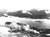 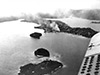 USN August 7, 1942 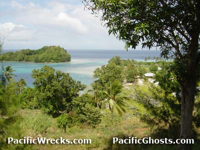 Justin Taylan 2003 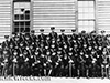 IJN February 14, 1942 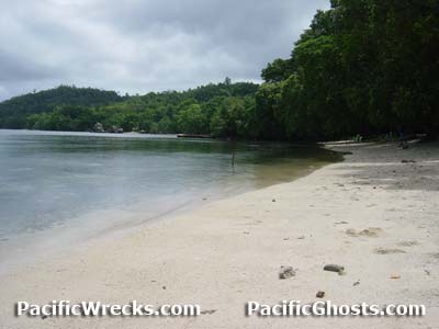 Justin Taylan 2003  USMC August 1942 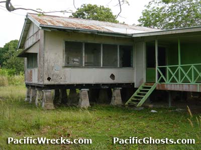 Justin Taylan 2003 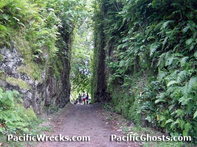 Justin Taylan 2003 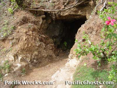 Justin Taylan 2003 |
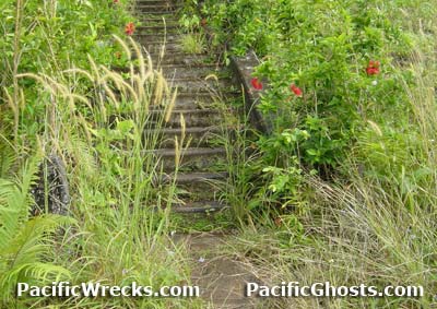
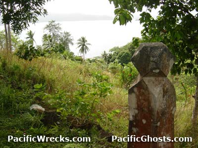
Location Lat 9° 5' 60S Long 160° 9' 0E Tulagi Island is part of the Florida Island Group (Florida Islands). Also spelled "Tulaghi". The Japanese referred to this location as "Tsuragi". Borders Tulagi Harbor (Tulagi Roads) and Florida Island (Nggela Sule, Big Gela) to the north. To the east is Macambo Island (Makambo) and Tulagi Seaplane Base located at Gavutu Island and Tanambogo Island (Tanombago). To the south are Mbangai Island, Kokomtambu Island and Songonangona Island and Iron Bottom Sound and beyond Guadalcanal. Prewar and during the Pacific War part of the British Solomon Islands Protectorate (BSIP). Today located in Central Province in the Solomon Islands. Prewar The British colonial government was based on Tulagi to administer the British Solomon Islands Protectorate (BSIP). During the prewar era, a small number of Japanese worked on the island in marine industries. Their presence and "yellow peril" sentiments led to the suspicion they were spies and were closely monitored. Before World War II, the Royal Navy (RN) surveyed Tulagi Harbor as a possible anchorage for the Asiatic Fleet and recommended developing this area as a naval base but the recommendation was never acted upon. A small force of Royal Australian Air Force (RAAF) personnel and Australian Army commandos defended Tulagi. On January 22, 1942 the first Japanese aircraft first bombed Tulagi and another air raid happened in early May 1942. Coastwatcher Gordon Train married to Vera Atkinson stayed behind on Tulagi and was lost on a flight to the Shortland Island to warn of the imminent Japanese invasion. On May 2, 1942 the Australian personnel and commandos were ordered to begin demolition of facilities then evacuated aboard two small boats bound for Port Vila in New Hebrides. On May 3, 1942 during "Operation MO", the invasion of Tulagi and Port Moresby, the invasion force arrives at Tuglagi Harbor and Okinoshima disembarks the Imperial Japanese Navy (IJN) 3rd Kure Special Naval Landing Force (SNLF) landing without opposition on Tulagi to establish Tulagi Seaplane Base on nearby Gavutu Island and Tanambogo Island (Tanombago). Starting May 4, 1942 targeted targeted by Allied bombers and fighters between May 4, 1942 until August 7, 1942. On August 7, 1942 during the first phase of the Guadalcanal campaign, U.S.. Navy carrier planes attacked targets on Tulagi ahead of the amphibious landing of U.S. Marine Corps (USMC) at Blue Beach on Tulagi Island and met fierce resistance from the Japanese defenders. By August 8, 1942 at nightfall, Tulagi was declared secure, but for several days, individual Japanese and small groups continued to be flushed from hiding places and hunted down by patrolling Marines. Americans killed on Tulagi were buried in three U.S. Cemeteries were established on Tulagi: USN & USMC Cemetery No. 1 (White Beach), USN & USMC Cemetery No. 2 (Police Barracks) and USN & USMC Cemetery No. 3 (Chinese Barracks). Later, these graves were exhumed and transported to American Cemetery Guadalcanal then postwar transported overseas for permenant burial. After the battle, Tulagi was developed into an American base area supporting future operations in the Solomon Islands and U.S. Navy vessels and PT Boats. Tulagi was targeted by Japanese aircraft during 1942-1943. Today After the war, the of colonial government moved to Honiara to utilize the infrastructure left by American forces. Tulagi again became the provincial capital. The facilities left in the area by the U.S. Navy are still used to this day, with pontoons and overhaul areas on the island still used for small craft. Tulagi Harbor Anchorage to the north of Tulagi also known as Tulagi Anchorage or Tulagi Road. Blue Beach Located on the western coast of Tulagi. On August 7, 1942 the U.S. Marine Corps (USMC) landed at this location. Sesapi Located on the northeastern tip of Tulagi bordering Tulagi Harbor. During World War II, U.S. Navy base and PT Boat base. District Residence House on Tulagi Island Located on one of the higher ridges on the island prewar. This house was built prewar as the home of the British district residence. Today, only the original staircase and stair posts remain. The house was rebuilt postwar until abandoned during 2003. Hill 281 Located at the center of Tulagi Island. This high ground was the main Japanese defensive position and headquarters on Tulagi, with tunnels and fighting positions built in the area. After the battle, Americans also defended this hill with machine guns for anti-aircraft defense. Hill 280 Located in the southeast center of Tulagi Island. Roadcut (The Cutting) This prewar roadcut into one of the ridges was heavily defended by the Japanese, who built cover into its side walls, most of these are covered with sediment. Also known as "The Cutting". Japanese Tunnels The Japanese built tunnels on Tulagi for defense. One entrance is located on an overgrown hillside. It opens into a deceivingly large tunnel inside. Another is located on the Catholic church property with two entrances, the second entrance is partially filled. References Thanks to John Innes, Peter Flahavin and Ewan Stevenson for additional information Contribute
Information Last Updated
|
Map 1943 Map II 1943 |
| Discussion Forum | Daily Updates | Reviews | Museums | Interviews & Oral Histories |
|