 |
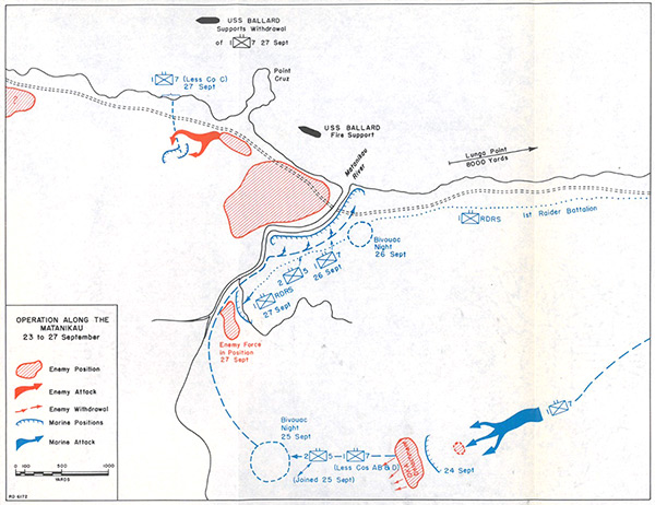
Map of "Operation Along The Matanikau 23 to 27 September" on Guadalcanal
The map indicates Point Cruz, mouth of the Matanikau River and the trail on the north coast of Guadalcanal. The double dotted line indicates the east-west walking trail on the north coast. The red areas indicate enemy positions. The red arrows indicate enemy attacks and the dotted arrows enemy withdrawals. The line with hatches indicates U.S. Marine Corps (USMC) positions and blue arrow Marine attacks by 7th Marines and 1st Raider Battalion advanced from the U. S. perimeter westward toward the Matanikau River. On September 27, 1942 embarked aboard landing craft at from Lunga Point, the the Marines (less Company C) land to the west of Point Cruz then advance inland to Hill 84 but the Japanese attack and force them to withdraw back to the beach supported by Naval gunfire from USS Ballard (AVD-10).
Credit: USMC Date: September 23, 1942–September 27, 1942
Map
High Resolution Version
Acquire This Image |
Contribute Information
Do you have photos or additional information?
Previous Page
|
|