 |
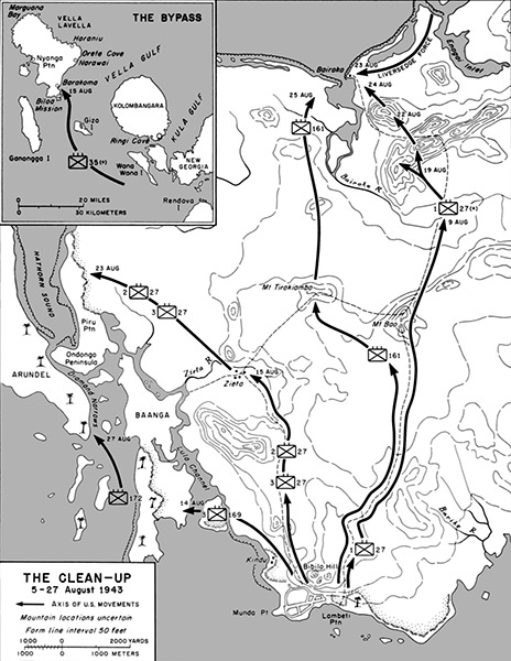
Map of The Clean-Up on New Georgia 5-27 August 1943
(Insert map) View of the central Solomon Islands including Rendova Island, New Georgia, Kolombangara, Kula Gulf, Vella Gulf, Gizo (Ghizo), Ganongga (Ranongga) and Vella Lavella.
(Main map). The black lines with arrow indicate axis of U.S. movements. 1) The "Liversedge Force" of U.S. Marine Corps (USMC) 1st Marine Raider Regiment under the command of Colonel Harry B. Liversedge advancing from Enogai along the Leland Lagoon westward toward Bairoko Harbor (Bauroko Harbor). 2) The U. S. Army 27th Infantry advanced August 19, 1942 and August 22, 1943 to occupy the high ground approaching Bairoko (Bauroko). 3) The U.S. Army 161st Infantry Regiment that advanced to Bairoko (Bauroko) on August 25, 1943.
Credit: U.S. Army Date: August 5-27, 1943
Map
High Resolution Version
Acquire This Image |
Contribute Information
Do you have photos or additional information?
Previous Page
|
|