Missing In Action (MIA)
Prisoners Of War (POW)
Unexploded Ordnance (UXO)
Chronology
Locations
Aircraft
Ships
Submit Info
How You Can Help
Donate
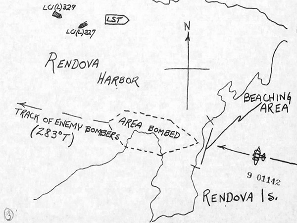
Map of Japanese air raid against
Rendova Harbor
on northern
Rendova Island
on
July 4, 1943
At the lower edge is northern
Rendova Island
, beaching area (East Beach) and Area bombed outlined by a dottled line. with the black line with arrow indicating the track of enemy bombers (283° T) over
Rendova Harbor
from east to west. The map indicates the position of
USS LCI(L)-329
,
USS LCI(L)-327
and Landing Ship Tank (LST) inside
Rendova Harbor
with
Bau Island
and
Kokorana Island
to the north.
Credit: USS LCI(L) 327 Report of Anti-Aircraft Action page 4 Date:
July 4, 1943
Map
High Resolution Version
Acquire This Image
|
Contribute Information
Do you have photos or additional information?
Previous Page
Discussion Forum
Daily Updates
Reviews
Museums
Interviews & Oral Histories
Pacific Wrecks Inc.
All rights reserved.