Yamamoto
Bunker
Map Room Chambers
Probably the most impressive feature of the bunker are the two
circular map room chambers, both are identical and on opposite
sides of the bunker, up narrow staircases. One chamber suffers
from some contemporary graffiti and water damage, although even
in that room, the maps are still in good shape.
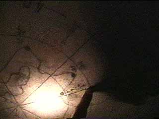
Ceiling Map
Overhead, there is a circular map of Rabaul, and the entire Gazelle Peninsula
area, with compass points and coordinates drawn out in every direction from the
bunker. Distances and coordinates are drawn out, presumably for Anti-Aircraft
and searchlight direction.
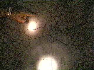
Harbor, Airfield and Strategic Wall Maps
On each wall are a number of other maps. One is a larger strategic
area map that shows all of New Britain, New Ireland and mainland
New Guinea. Another map is a detail of the harbor. Another map
shows all of the Rabaul Area airfields: Vunakanau,
Laukuna, Rapopo and Tobera.
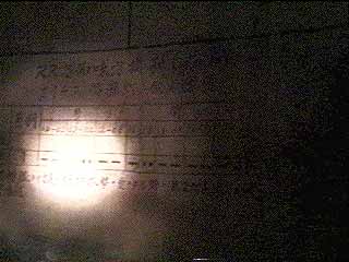
"RR"
Below the map, is Japanese writing in a table with grid locations
and coordinates. The letters "RR" are the Japanese designation
for "Rabaul"
Return to Bunkers
| Rabaul | Main Page