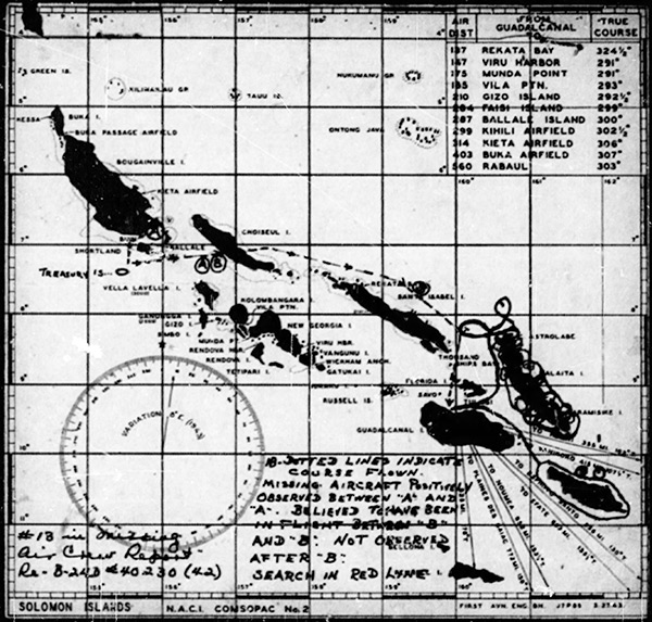
Map depicting flight path of B-24D 42-40230 and search routes
The base map is Solomon Islands N.A.C.I COMSOPAC No. 2 with annotations and hand written annotations.
The annotations on the map include "A" at Kahili Airfield on Bougainville and a dotted line to the southwest then south to the west of Shortland Island towards Treasury Islands then eastward toward Choiseul Island (Lauru) with "A" and "B" then southeast roughly parallel to the north coast of Santa Isabel Island (Isabel) then south to Carney Airfield (Bomber 2) on Guadalcanal. Search missions flown are indicated by circles over the coast of Malaita Island and a search around the perimeter of San Cristobal Island (Makira).
The hand written
annotations at the lower edge include:
(lower left) "#1B in Missing Air Crew Report Re - B-24D #40230 [B-24D 42-40230] (42)
(lower right) "1B - Dotted lines indicate course flown missing aircraft positively observed between 'A' and 'A'. Believed to have been in flight between 'B' and 'B' not observed after 'B'. Search in red line." Credit: MACR 45A Date: July 1943
Map