Missing In Action (MIA)
Prisoners Of War (POW)
Unexploded Ordnance (UXO)
Chronology
Locations
Aircraft
Ships
Submit Info
How You Can Help
Donate
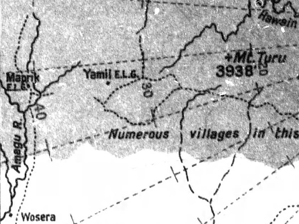
Map of the interior of
New Guinea
The map includes
Maprik (Kominibus)
,
Maprik Airfield (Maprik E.L.G., Hayfield Airfield)
, Amagu River, Wosera,
Yamil
, Yami Airfield (Yamil E.L.G.) with numberous villages in this area. walking trails (dotted lines) and Mount Turu (Mt. Turu) elevation 3,938' and the Hawain River.
Credit: MACR 3981 page 2 Date:
August 30, 1943
Digital
Enlargement
High Resolution Version
Acquire This Image
|
Contribute Information
Do you have photos or additional information?
Previous Page
Discussion Forum
Daily Updates
Reviews
Museums
Interviews & Oral Histories
Pacific Wrecks Inc.
All rights reserved.