 |
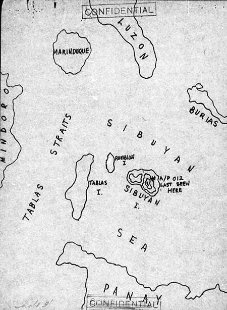
Map of the loss of B-25J "Lazy Daisy Mae" 43-36012 over Sibuyan Island
The * indicates "A/P [Airplane] 012 [B-25J "Lazy Daisy Mae" 43-36012] last seen here". The map includes the Bicol Peninsula of southeast Luzon, Burias Island, Sibuyan Sea, the northern edge of Panay, Mindoro Island, Tabalas Straits (Tabuas Strait), Tabalas Island, Romblon Island, Sibuyan Island in the Sibuyan Sea, and Marinduque Island in the Philippines.
Credit: MACR 11792 page 4 Date: January 9, 1945
B&W
High Resolution Version
Acquire This Image |
Contribute Information
Do you have photos or additional information?
Previous Page
|
|