|
|
|
|
| Missing In Action (MIA) | Prisoners Of War (POW) | Unexploded Ordnance (UXO) |
| Chronology | Locations | Aircraft | Ships | Submit Info | How You Can Help | Donate |
|
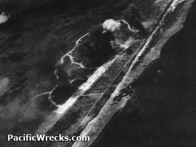 USAAF May 27, 1944 USAAF May 27, 1944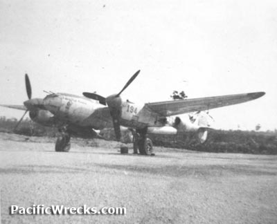 475th FG July 1944 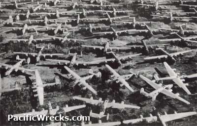 c1950 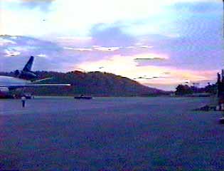 5th AF Assoc 1990 |
Location Lat 1° 11' 24S Long 136° 6' 29E Mokmer Airfield is located to the west of Mokmer less than 100 yards from the beach parallel to the southern coast of Biak bordering Yapen Strait (Japen Strait). Also known as Mokmer Drome. This is the eastern most of the three coastal airfields on Biak. To the west is Borokoe (Boroekoe, Borokoe) and Sorido (Sorrido, Insirom, Insrom). Today located in Biak Numfor Regency, Papua Province in Indonesia. Construction Built by the Japanese as a single coral surfaced runway with taxiways and ravetments to the north of the runway. Wartime History Used by the Japanese until the U.S. Army landing on Biak May 27, 1944. During the middle of 1944 attacked by American bombers to netralize the runway. American missions against Mokmer April 28, 1944–May 7, 1944 During late May 1944, Mokmer was liberated by the U.S. Army but entrenched Japanese Army 222nd Infantry in the high ground and caves delayed the use of the airfield for American planes. Repaired, by U.S. Army engineers for use by fighters and medium bombers. By August 1, 1944 the runway was expanded to 7,000'. Designated U.S. Army APO 920. Tower code name "Lordship". American units based at Mokmer 49th FG, 9th FS (P-38) Hollandia arrives June 26, 1944–October 24, 1944 departs Tacloban 475th FG, 433rd FS (P-38) Hollandia arrives July 14, 1944–November 11, 1944 departs Dulag 475th FG, 431st FS (P-38) Hollandia arrives July 15, 1944–November 9, 1944 departs Dulag 345th BG, Headquarters (HQ) Nadzab arrives July 23, 1944–November 12, 1944 departs Dulag 345th BG, 498th BS (B-25) Nadzab arrives July 13, 1944–November 12, 1944 departs Dulag 345th BG. 501st BS (B-25) Nadzab arrives July 23, 1944–November 12, 1944 departs Dulag 345th BG, 500th BS (B-25) Nadzab arrives July 23, 1944–November 9, 1944 departs Dulag 345th BG, 499th BS (B-25) Nadzab arrives July 24, 1944–November 11, 1944 departs Dulag Postwar Mokmer Airfield became a major reclamation area for all types of surplus Allied aircraft abandoned on Biak. During the 1950s until the early 1960s, Mokmer Airfield was used as a refueling point for jet airliners flying from the United States to Indonesia, prior to non-stop transpacific flights. Still in use today as a civilian airport known as "Frans Kaisiepo International Airport" or "Frans Kaisiepo Airport" but also remains known as Mokmer Airport. Airport codes: ICAO: WABB and IATA: BIK. The single runway is oriented 29/11 and measures 11,715' x 150' surfaced with asphalt. References Frans Kaisiepo International Airport Biak official website Contribute
Information Last Updated
|
May 1944 Map Fallingrain |
| Discussion Forum | Daily Updates | Reviews | Museums | Interviews & Oral Histories |
|